All the photos are now Geocoded and Labeled
September 25, 2009 at 3:54 am | Posted in NFCT | 2 Comments Mahsa has put her genius to work and has geocoded all our pictures and labeled them. This means you can go through the photo album and follow along with the map. Its a great way to get a sense of the trip as a whole and see the pictures with little captions and such. Yay!
New Journal Entries and Pictures
September 10, 2009 at 12:34 pm | Posted in NFCT | Leave a commentHey, hey!
We have been hard at work getting journal entries typed up. You can now read days 1-18 (with accompanying pictures) when you scroll down. We’ll have days 19-35 up just as soon as we can.
Day 35: We Made It!
August 21, 2009 at 11:45 pm | Posted in NFCT | 4 CommentsTags: Canoeing, NFCT

Us at the end of the NFCT in Fort Kent, ME
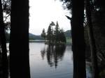
35 days after leaving Old Forge, NY we have arrived in Fort Kent, ME and the end of the Northern Forest Canoe Trail. 740 miles of paddling, portaging and lets face it mucking our way through the Northern Forests. We can’t say it was always graceful or pretty but it was fantastic fun and adventure. We’ll be a bit sad to leave the daily camp life behind but coming home sounds pretty good right about now (especially with all the storms moving in!). We paddled hard for the last week putting in 30+ mile days. 4am starts got us across some of Maine’s largest lakes without a hitch. The sunny days and warm weather made sure we didn’t have to do any more knee deep wading in mud and the Allagash river was a friend as well as a challenge. Its quick waters sped us along and its rapids pushed us into admitting we have actually learned a thing or two along this trail. The rapids were amazing fun and the scenery enchanting. We saw 5 moose in one day! Swimming along in the water beside us. As we paddled into Fort Kent today we saw and Eagle swooping and diving for prey in the water. A fine mist hung over the St. John Valley and we were reminded of how lucky we have been to see and experience the past 5 weeks. Thanks to everyone along the way who made it all work. From the guys at the dam who gave us cold water on the hottest day to the ranger at Chamberlain lake who gave us brownies when we looked pretty defeated to Kathy at Kathy’s Country Store in Vermont whose ice cream mended all wounds and hornet stings and everyone else along the trail…you made it work out and made it all possible. You are all as much a part of the adventure as the many dozens of water ways we traversed.
We have pictures glalore and even more stories and we can’t wait to share them with you all. We’ll be updating the blog as soon as we can with our journal entries from the trip.
Onward!
Mahsa, Morrigan and The Flora Burn
Updated photos 3!
August 4, 2009 at 3:47 pm | Posted in Uncategorized | 2 CommentsAfter a stop at the library here is the largest batch of photos yet. Starting from the beginning of the trip, there are a few repeats but mostly new! Click the photo to see them!

Day 18
August 4, 2009 at 3:10 am | Posted in NFCT | Leave a commentWe awoke and began the day with showers! We then packed up and dragged our canoe to the outfitters and left her there while we went and explored downtown Newport.

newport library
We went to the library, which was in an old beautiful building. The upstairs had great huge meeting rooms with old cushy chairs and the hallway was lined with a glass case filled with stuffed (taxidermies) animals. Then we went to a great diner called My Family Recipe Diner. Some grilled cheese sandwiches and corn chowder later we set off to a local natural food store. Its here that picked up what became one of the best additions to our food stores – powdered soy milk. It has greatly improved our morning oatmeal and our mash potatoes. We then headed to catch our shuttle. The guy doing the shuttle was a young employee of the outfitter. He obviously hadn’t loaded many canoes on trucks before but we managed to get it on – or so we thought. Turns out he hadn’t rigged up the come-along winches properly and one came off. Half way to Salem Lake Flora fell off the truck! We both saw the trip end right there. Our hearts stopped. Thank god there wasn’t any on coming traffic! Flora it turns out can really take a beating. She was in fine shape and we tied her back on (Mahsa and me taking the lead on securing her). We made it to the lake with out anymore trouble and with relief said goodbye to the shuttle.
We again checked over Flora for any damage and found none. She really is a trooper. As we were loading up and preparing to set off across the lake a summer day camp unleashed upon the lake and dozens of kids suddenly swarmed the lake in kayaks. It was total chaos! Hilarious chaos! Most of the kids were tiny and totally dwarfed by the kayaks. We watched the mess for a while before finally setting out.
The wind on Salem Lake was strong and blowing right into us. It took forever to cross a 2 mile lake! After Salem Lake was a small pond and then the Clyde river. The Clyde is narrow, fast moving and littered with blow downs and as usual we were going up stream – which made it even more difficult to navigate. We got to a turn with a couple of blow downs back to back, so we deicide to try and find a way around. Morrigan went into the brush to find a possible portage around and in the process stepped on a hornets next. She ran frantically towards the canoe, where Mahsa yelled for her to jump in and PADDLE! Paddling was hard given that the hornets were still attacking Morrigan, bighting her hands and arms. We made it to a small bank where Morrigan leapt out and looked like she might throw up. We frantically pulled out the first aid kit and applied sting relief to the 12+ bites. At this point we decided that we had had enough of the clde and we were going to pull out and hit the road to the next pond. We really weren’t that far from when we’d have to pull out anyway. We managed some tricky maneuvering around the strainers and up the river to another bend. Here we found a place to pull out of the water next to an oozing pile of garbage.

the oozing garbage pile
It was nasty and smelled of stale and rancid beer. Once we had gotten through the garbage and up onto the road we walked along the road stopping at Kathy’s Corner Store where we got some snacks to help us through our rather arduous day: tuna helper, canned beats, ice cream bars. Kathy also gave us some much needed encouragement telling us she was so proud of us girls (we were the first team of all girls she’d seen come thru attempting the trail). The guys out front were also great (in fact hilarious). One guy was the leader (the wise man who knew the most), the guy with the fly swatter who interjected when needed, and the guy who offered comic relief (who also had a miniature American Eskimo dog who barked at cars coming into the gas station). From here we portage uphill and over rapids which were much harder then advertised. WE made it to our put in and paddled across a small, lovely pond to a camp site. We had tuna helper for Mahsa’s b-day dinner. That night we didn’t flip the canoe or put up the tarp since everyone it wasn’t going to rain. But of course it did. In the middle of the night a loud clap of thunder ushered in the rain that would last all night.
-

- mahsa’s birthday cake
-

- Inside the library
-

- Inside the library
-

- Rapids we couldn’t go upstream on

-
- the view from camp
-

- newport library
-

- the oozing garbage pile
Day 17
August 3, 2009 at 3:44 am | Posted in NFCT | Leave a commentWe woke up and took advantage of the sunny day by airing out all our wet gear.

Our lunch spot
We talked to the attendant about having Flora washed (per lake Memphremagog regulations to prevent Zebra muscles and invasive aquatic plants). He was kind enough to do it for free! Saving us from having to explain that we didn’t have any Canadian money. We then set off across Lake Memphremagog in beautiful sunny weather. The lake is truly magnificent. We stopped for lunch and water after a time and saw a funny old man swimming around in a speedo! Somewhere along our paddle we crossed from Canada to the U.S. The only marking of this were some buoys floating out in the water.
When we arrived in Newport, VT we tied Flora u to the ducat the marina (right next to the harbor masters boat!) and went to check-in with U.S. customs. But no one was there! Outside the office was a phone that it was indicated one should use if no one was in the office. Mahsa picked up the phone and a nice man on the other end (who knows where he was, could have been in Indiana for all we know) answered. She gave our names and where we had been and where we were going.

phoning customs
He asked for the name of our boat to which Mahsa replied “it’s a canoe”. He didn’t really know what to do with that. You could see him trying to find the right check box for canoe on some form. Mahsa then said “it’s a green canoe if that helps”. Apparently that did because the guy sounded relieved. After this we headed into town to see about arranging a shuttle around the lower Clyde and some big rapids. We made arrangements for a shuttle the next day found out where the local library was and then headed back to our canoe. A quick paddle across the bay got us to the camp ground (mostly if not entirely RV’s). Some of these RV’s were definitely there for the whole summer. One even had a vegetable garden! We set up camp and headed down the hill to where we heard there was a nice little restaurant, the Eastside Grill. To say we gorge ourselves would be an understatement. Best of all was the all you can eat salad bar. Fresh vegetables have been in short supply on this trip.
With over full bellies we made our way back to camp and lights out.
-

- packing the canoe
-

- border bouy
-

- NFCT sign in Newport
-

- flora parked next to the harbormaster
-

- view from the restuarant
-

- yum, veggies
-

- Our lunch spot
-

- phoning customs
Day 16
August 2, 2009 at 4:00 am | Posted in NFCT | Leave a commentWe awoke early and lethargic. It has become hard to feel motivated each morning when the prospect of a good day of paddling is so grim. But we set off none-the-less. The water did seem to have gone down a bit and the color had returned to normal (the rain had turned it a muddy color). We paddled hard up stream without too much trouble. We got ourselves around some rough spots where swollen streams met the river causing swift current and riffles. A couple of times we had to get out and drag the canoe. But we made did it. Many turns and trick maneuvers around fallen trees and brush and few challenging moments where other streams entered the river brought us to the days real first challenge.
As we rounded a curve in the river we saw ahead a large old bridge abutment in the middle of the river. This is marked on the map but coming at it while paddling upstream is all together different then coming from upstream. Water flowed in three channels making three difficult places to paddle. We opted to line up the right side as it offered a place to eddy out and places to stand. We got all set to the line and began the careful task of selecting stable rocks to stand on. We got Flora up the main channel of moving water and into a little eddy. But here we were posed with a little dilemma. Between us and more shore line was a sheer rock wall coming out of the water – the other side of the what use to be a bridge. The water below the wall is deep, to deep to wade. After carefully scouting a way over and around Morrigan decided the only thing to do would be to climb the wall. So she did. Carefully she worked her way across the wall to a low nook. Mahsa then pushed the canoe to her. While Morrigan held the canoe Mahsa got in and together they brought it over to another little eddy. Together we walked through the shallow water and riffles with the canoe to deeper slower water. It was hard work but rather work hard and be successful then work hard only to have to turn back in defeat.
Not long after the bridge we found ourselves fighting to get around a bend in the river. The rain had swollen the streams entering the river. Where they entered the current became almost unmanageable when paddling upstream. But we made it, slowly but surely. After leaving the main branch of the Missisaquoi we paddled up the North Branch to Milton. The rain really began to pick up as did the current. The North Branch is much narrower then the main branch and moves at a bit of a quicker pace. After some harrowing paddles through some pretty swift patches of water we called it quits. The current had become ridiculous. We hoofed it up to the road and began a two mile walk to Milton.

camping spot for the night
We had almost made it all the way via water, making the pullout even more bitter. The rain came down in sheets. To boot Milton sits atop a HUGE effing hill. The struggle to the top was actually hilariously steep. It was possibly the steepest thing we could have dragged our canoe up. At the top we spied a gazebo and who should also be seeking refuge from the rain but Isabel and Denis! They welcomed us and asked for our tales of woe, which we shared. They then did the nicest thing ever and offered us a ride to our next camp spot at Perkins Landing (the map shows another camp spot north of Perkins Landing. This is not a camp ground but a place for private RV camps). Technically camping isn’t permitted at Perkins Landing but if you ask the guy who tends to the landing he’ll let you camp in the pic nic area.
After saying fond goodbyes to Isabel and Denis we set up as rain proof camp as we could. We dined on instant mashed potatoes, stuffing and gravy. We ate so much that we both felt a little sick. But being full and dry and warm was a far better way to be then what we could have been had we not had the good fortune of seeing Denis and Isabel.
Day 15
August 1, 2009 at 4:06 am | Posted in NFCT | Leave a comment
Richford
We slept well in Richford and awoke anxious to get on the river. Alas! it was not to be. The previous days deluge of rain had turned the Missisaquoi into a fast moving, muddy mess of a river for any upstream paddler. A frustrating and round about adventure into the brambles only cause more heart ache as we couldn’t find a way down to the river. So once again we struck out on foot along a narrow highway with no shoulder. Our moods were foul and not helped by only having snickers bars for breakfast.
We walked along Highway 512, which of course had no shoulder for quite some time. About three miles from the border a women in a pick up truck pulled over and asked if we’d like a ride – we sure did! We tied the Flora Burn on her roof and threw our gear in the back and were off to the border. Flora was not tightly secured to the roof and every time we hit a big bump she’d catch some air! In the truck with us was a little puppy named Bo who tried to eat Mahsa’s hair and glasses strap.
The adventure really began to take a turn for the strange when the woman reached the border and pulled the wrong way in the U.S. Customs (the exit). The customs officers (who must have been 12) were thoroughly confused. After a time it seemed all the customs officers questions were more about of curiosity then anything else. We unloaded our canoe, thanked the lady who gave us a ride and tried to decide what to do. One look at the muddy river told us that we would be hoofing it into Canada. By this point we’d become used to the inevitability that we’d be walking more then paddling on the Missisaquoi River. Basically Highway 512 and 243 had become part of the trail.
Canadian Customs was a breez. The woman only asked us if we had apples or mace. We had no mace but said we had 4-12 apples. After this brief questioning we struck out afoot across Quebec.
The sun was blazing and our progress slow. After about 2 miles we came to a large field where a lot of cars were parked, including a van with a large canoe trailer on it. Well holy heck we were excited! This meant that somewhere down there was access to the river.

crossing the border
A short scout later showed us a nice spot to put in. The river was up and moving fast but was smooth and deep rather then churning and riffling. We felt we could do it, especially since our arms were so well rested after many days of not paddling much. We partook in a short nap in the shade of a large tree before setting out. As we were packing up a couple women pulled up in a fancy SUV with two kayaks on the roof. They asked of if we were English. Assuming they meant to ask if we spoke English we said yes. They were also looking for a way to put into the river.
A short time later we found ourselves in the water paddling hard. We mean hard. Presently we encountered the source of the increasing current – a rapid formed likely by high water. Four or Five failed attempts at getting through the main channel of water vexed us. We pulled out and began to scout a way around. A bog, rock and half river wide strainer prevented a straight portage around. So Morrigan got out to bush whack a path to a field.
We lugged, pulled and trudge our gear up a steep embankment, through chest high grass and eventually to a big open field. Getting Flora out of the water and to the field was quite a feat that even attracted a small crowd on the opposite bank.

broken hearted
Heart broken, dejected and yes disgusted we sat on the field amidst our gear feeling pitiful. Doing what we know best, we struck out on foot to walk along a busy road with no shoulder towards a campsite. The campsite is at a local canoe rental spot outside of town. As we were walking – because it is a long, long walk if you are having to get out downstream – a car pulled up behind us. We were feeling a bit lost so we went to ask if they could show us where we were on the map. This is how we met the two greatest folks, Denis and Isabella, two fellow canoeists. They were on vacation and a bit lost themselves. They were really interested in what we were doing and in our canoe cart. As we were talking another car came by and when the guy pulled up along side us he yelled excitedly “Northern Forest Canoe Trail!” It was Francois the owner of the canoe rental shop where we would be camping. He suggested that we leave our canoe on the road and he would come by to get it on his way back. Denis and Isabel said they would be happy to take us and our gear the rest of the way to Francois. Turns out the Denis is also a writer for outdoor magazines! Both were enthusiastic to learn more about our trip. So a mile or two later we were all sitting at Francois chatting and telling stories. Soon though Denis and Isabel had to be on there way. We said our goodbyes and went to set up camp for the night. The weather was fare so we also laid out our gear to dry.
That night we slept well enough. Though no one could deny that our spirits were low. The Missisaquoi River just couldn’t cut us a break.
-

- crossing the border… on foot
-

- just a reminder that we’re now in metric territory
-

- this is what we had pull flora up
-

- and the we had to push her through this
-

- yoga street signs?
-

- disheartened map studying


-

- broken hearted
Day 14
July 31, 2009 at 8:20 pm | Posted in Uncategorized | Leave a commentWoke up early to a sunny morning in Enosburg Falls. We packed up camp fairly quickly and hit the river. Easy, fun and beautiful paddling up the Missisquoi welcomed us. We paddled on for about 7 miles, laughed and too it easy. The current started to pick up around Samsonville while the river also shallowed out. Tricky upstream maneuvering around sand bars was required. We approached the base of some class II ledges that proceed an old breeched dam. Carefully we looked for a way around…finding none at the immediate base of the ledges we started to float back down stream looking for a take out. After 3-4 disappointing scouting adventures into fields of corn we paddled back up stream. Mahsa had spotted a small stream entering on the river left (if going up stream) that could provide a good place to get out. We paddled hard across the the river to the stream, which was deap, but not long. A quick scouting revealed that we could whack our way through some brush to get on the very same Rails to Trails path we were on the other day. It was a bit harder then we first thought owing to the steepness of the bank. We pulled and pushed and all our gear and the Flora Burn up and out of the brush. Did we mention that this whole time it was raining? Hard. Well it was. We wrapped up Flora and our gear with tarps and wheeled down the path looking for a way to put back in the river past the old dam. We walked and walked and walked….all the way to East Birkshire, VT.
Just as the map suggested we enjoyed some sandwiches at Dick and Pams general store while we contemplated what to do next. The put into the river was obvious but what was also obvious was that the river was moving swiftly. After such a glorious morning of paddling turned trudge through the rain we were feeling defeated and let down. We both may have given up at different points this day. Our up river journey on the Missisaquoi was taking its toll.
At Dick and Pams we were able to talk to a local canoeist who about water conditions up river. He assured us that he didn’t think we would have any real trouble and that the current would slow down after a bit. So we put in and began to paddle hard up stream. The put in is just below the confluence of the Trout and Missisaquoi rivers. After about 10 minutes of extremely hard paddling that got us only a few hundred feet we found ourselves grounded on a sand bar between two fast moving channels of water. Morrigan slumped forward and actually said “I want to go home”.
We turned the canoe around and swiftly found ourselves back at the launch spot. We once again dragged and pulled our gear and canoe up a steep embankment to a road and eventually to the rails to trails path. There we found ourselves trudging a long 5 milees in the rain to Richford, VT.
Entering Richford we were instantly struck with the feeling that Richford is a town ong since passed its prime. Building facades that were once grand were fading and boarded up. In fact, it appeared that most of Richford’s downtown was boarded up. But in fine Northern Kingdom fashion the people were wonderful , welcoming and friendly. We made camp in the town park amid the sounds of playing kids and families enjoying the long summer evenings.


Updated photos 2
July 30, 2009 at 9:54 pm | Posted in Uncategorized | 2 CommentsHere a more photos from the trip! Click the photo to see them!

Blog at WordPress.com.
Entries and comments feeds.
